Geolocate

Ghartholi topographic map

Click on the map to display elevation.

About this map

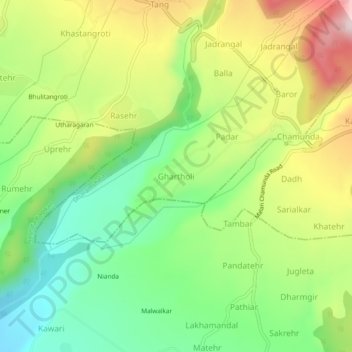
Name: Ghartholi topographic map, elevation, terrain.

Location: Ghartholi, Dharmsala, Kangra, Himachal Pradesh, 176052, India (32.12410 76.38370 32.16410 76.42370)

Average elevation: 3,386 ft

Minimum elevation: 2,844 ft

Maximum elevation: 4,150 ft

Gear up for your next adventure:

📷Action Camera - Capture your outdoor adventures in HD
🧦Merino Wool Socks - Moisture-wicking, blister-preventing socks for long treks
❄️Traction Cleats - Prevent slips on icy trails during winter hikes
🥾Men's Hiking Boots - Durable, waterproof footwear for rugged terrain and steep inclines
🔦Powerful Headlamps - Ultra-bright hands-free lighting for night navigation

As an Amazon Associate, this site earns from qualifying purchases at no extra cost to you.