
Thank you for supporting this site ❤️
Make a donation
Make a donation
Gear up for your next adventure:
As an Amazon Associate, this site earns from qualifying purchases at no extra cost to you.
Orlen topographic map
Click on the map to display elevation.
Thank you for supporting this site ❤️
Make a donation
Make a donation
Gear up for your next adventure:
As an Amazon Associate, this site earns from qualifying purchases at no extra cost to you.
About this map
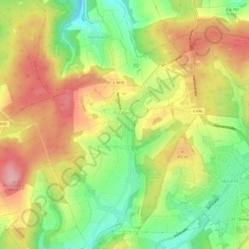
Name: Orlen topographic map, elevation, terrain.
Location: Orlen, Taunusstein, Rheingau-Taunus-Kreis, Hessen, Deutschland (50.16559 8.16969 50.19323 8.22822)
Average elevation: 1,385 ft
Minimum elevation: 1,142 ft
Maximum elevation: 1,624 ft
Thank you for supporting this site ❤️
Make a donation
Make a donation
Gear up for your next adventure:
As an Amazon Associate, this site earns from qualifying purchases at no extra cost to you.