
Aïn Tagourait topographic map
Interactive map
Click on the map to display elevation.
About this map
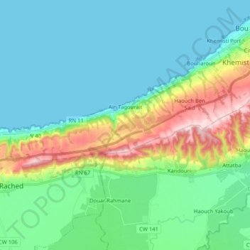
Name: Aïn Tagourait topographic map, elevation, terrain.
Location: Aïn Tagourait, Bou Ismail District, Tipaza, 42023, Algeria (36.57410 2.50655 36.61271 2.66486)
Average elevation: 210 ft
Minimum elevation: -7 ft
Maximum elevation: 883 ft