
Thank you for supporting this site ❤️
Make a donation
Make a donation
Gear up for your next adventure:
As an Amazon Associate, this site earns from qualifying purchases at no extra cost to you.
燕窝宕 topographic map
Click on the map to display elevation.
Thank you for supporting this site ❤️
Make a donation
Make a donation
Gear up for your next adventure:
As an Amazon Associate, this site earns from qualifying purchases at no extra cost to you.
About this map
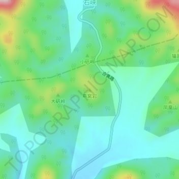
Name: 燕窝宕 topographic map, elevation, terrain.
Location: 燕窝宕, 钱铺镇, 枞阳县, 铜陵市, 安徽省, 中国 (30.99101 117.47535 30.99111 117.47545)
Average elevation: 541 ft
Minimum elevation: 308 ft
Maximum elevation: 1,220 ft
Thank you for supporting this site ❤️
Make a donation
Make a donation
Gear up for your next adventure:
As an Amazon Associate, this site earns from qualifying purchases at no extra cost to you.