
Thank you for supporting this site ❤️
Make a donation
Make a donation
Gear up for your next adventure:
As an Amazon Associate, this site earns from qualifying purchases at no extra cost to you.
Langwies topographic map
Click on the map to display elevation.
Thank you for supporting this site ❤️
Make a donation
Make a donation
Gear up for your next adventure:
As an Amazon Associate, this site earns from qualifying purchases at no extra cost to you.
About this map
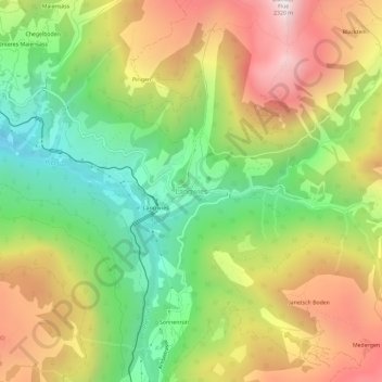
Name: Langwies topographic map, elevation, terrain.
Location: Langwies, Arosa, Plessur, Grisons, 7057, Suisse (46.80089 9.69236 46.84089 9.73236)
Average elevation: 5,466 ft
Minimum elevation: 3,773 ft
Maximum elevation: 7,484 ft
Thank you for supporting this site ❤️
Make a donation
Make a donation
Gear up for your next adventure:
As an Amazon Associate, this site earns from qualifying purchases at no extra cost to you.