Geolocate

Harbor topographic map

Click on the map to display elevation.

About this map

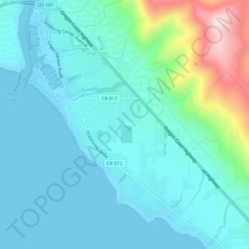
Name: Harbor topographic map, elevation, terrain.

Location: Harbor, Curry County, Oregon, United States (42.02257 -124.27413 42.05529 -124.23299)

Average elevation: 233 ft

Minimum elevation: 0 ft

Maximum elevation: 1,280 ft

Curry County trails, hiking, mountain biking, running and outdoor activities

Gear up for your next adventure:

❄️Traction Cleats - Prevent slips on icy trails during winter hikes
🦶Carbon Trekking Poles - Reduce knee impact on steep descents with ultra-light poles
🧺Microfiber Travel Towels - Compact and fast-drying towels for trail use
🔭Telescopic Hiking Pole - Adjustable pole for hiking stability
🏔️Mountain Trail Maps - High‑detail maps for popular peaks

As an Amazon Associate, this site earns from qualifying purchases at no extra cost to you.