
Thank you for supporting this site ❤️
Make a donation
Make a donation
Gear up for your next adventure:
As an Amazon Associate, this site earns from qualifying purchases at no extra cost to you.
Dobrná topographic map
Click on the map to display elevation.
Thank you for supporting this site ❤️
Make a donation
Make a donation
Gear up for your next adventure:
As an Amazon Associate, this site earns from qualifying purchases at no extra cost to you.
About this map
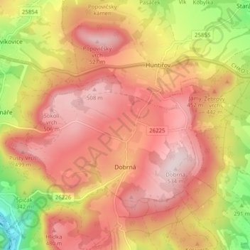
Name: Dobrná topographic map, elevation, terrain.
Location: Dobrná, okres Děčín, Ústecký kraj, Northwest, 40741, Czechia (50.76245 14.25625 50.79286 14.33340)
Average elevation: 1,263 ft
Minimum elevation: 505 ft
Maximum elevation: 1,732 ft
Thank you for supporting this site ❤️
Make a donation
Make a donation
Gear up for your next adventure:
As an Amazon Associate, this site earns from qualifying purchases at no extra cost to you.