Geolocate

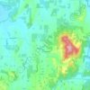
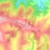
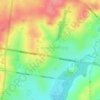
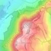
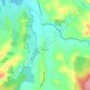
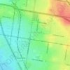
Selby topographic map

Click on the map to display elevation.

About this map

Name: Selby topographic map, elevation, terrain.

Location: Selby, Melbourne, Shire of Yarra Ranges, Victoria, Australia (-37.91483 145.37306 -37.91461 145.37326)

Average elevation: 797 ft

Minimum elevation: 502 ft

Maximum elevation: 1,240 ft

Other topographic maps

Click on a map to view its topography, its elevation and its terrain.
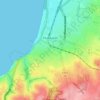
Frankston

Australia > Victoria > Melbourne

Olivers Hill is the most prominent elevation in Frankston which rises to 55 metres above sea level (180 feet) at its highest point in the suburb. Its origins date to approximately 415 to 360 million years ago. Its base is Mount Eliza Granite dating from the Devonian period, which was covered in lava tuffs in…

Average elevation: 131 ft
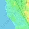
Elwood

Australia > Victoria > Melbourne

Average elevation: 26 ft

Keilor

Australia > Victoria > Melbourne

Average elevation: 236 ft

Kew

Australia > Victoria > Melbourne

Average elevation: 125 ft

Heidelberg

Australia > Victoria > Melbourne

Average elevation: 161 ft

Emerald

Australia > Victoria > Melbourne

Average elevation: 738 ft

Footscray

Australia > Victoria > Melbourne

Average elevation: 62 ft

Lysterfield Park

Australia > Victoria > Melbourne

Average elevation: 374 ft

Gruyere

Australia > Victoria > Melbourne

Average elevation: 459 ft

Wandin North

Australia > Victoria > Melbourne

Average elevation: 604 ft

South Kingsville

Australia > Victoria > Melbourne

Average elevation: 56 ft

Dandenong Ranges

Australia > Victoria > Melbourne

The topography consists of a series of ridges dissected by deeply cut streams. Sheltered gullies in the south of the range are home to temperate rain forest, fern gullies and Mountain Ash forest Eucalyptus regnans, whereas the drier ridges and exposed northern slopes are covered by dry sclerophyll forest of…

Average elevation: 1,496 ft
Mount Eliza

Australia > Victoria > Melbourne

Average elevation: 197 ft

Yarra Valley

Australia > Victoria > Melbourne

The Yarra Valley is the region surrounding the Yarra River in Victoria, Australia. The river originates approximately 240 km (150 mi) east of the Melbourne central business district and flows towards it and out into Port Phillip Bay. The name Yarra Valley is used in reference to the upper regions surrounding…

Average elevation: 1,001 ft
Box Hill

Australia > Victoria > Melbourne

Average elevation: 305 ft

Hillside

Australia > Victoria > Melbourne

Average elevation: 440 ft

Pakenham

Australia > Victoria > Melbourne

Average elevation: 184 ft

Montrose

Australia > Victoria > Melbourne

Montrose varies in altitude from about 91 m to 324 m above sea level. Montrose covers an area of 11 square kilometres (2,700 acres).

Average elevation: 771 ft

Viewbank

Australia > Victoria > Melbourne

Average elevation: 138 ft

Portsea

Australia > Victoria > Melbourne

Average elevation: 20 ft

Woodlands Historic Park

Australia > Victoria > Melbourne

Average elevation: 456 ft

Mickleham

Australia > Victoria > Melbourne

Average elevation: 781 ft

Rosebud

Australia > Victoria > Melbourne

Average elevation: 144 ft

Dandenong South

Australia > Victoria > Melbourne

Average elevation: 59 ft

Maribyrnong

Australia > Victoria > Melbourne

Average elevation: 75 ft

Red Hill

Australia > Victoria > Melbourne

Average elevation: 633 ft

Kalorama

Australia > Victoria > Melbourne > Kalorama

Average elevation: 873 ft

Viewbank

Australia > Victoria > Melbourne > Viewbank

Average elevation: 203 ft

Jawbone Reserve

Australia > Victoria > Melbourne

Average elevation: 16 ft

Melton District

Australia > Victoria > Melbourne

Average elevation: 469 ft

Fitzroy

Australia > Victoria > Melbourne

Fitzroy's topography is flat. It is laid out in grid plan and is characterised by a fairly tightly spaced rectangular grid of medium-sized streets, with many of its narrow streets and back lanes facilitating only one-way traffic. Its built form is a legacy of its early history when a mixture of land uses was…

Average elevation: 115 ft

Steels Creek

Australia > Victoria > Melbourne

Average elevation: 781 ft

Melbourne Airport

Australia > Victoria > Melbourne

Average elevation: 344 ft

Croydon South

Australia > Victoria > Melbourne

Average elevation: 387 ft

Gembrook District

Australia > Victoria > Melbourne

Average elevation: 545 ft

Vermont South

Australia > Victoria > Melbourne

In 1966 the Metropolitan & Melbourne Board of Works (MMBW) put forth a plan to construct numerous "package" sewage treatment plants in the valleys of Dandenong Creek and its tributaries. The project aimed to provide adequate sewerage to the catchment before the Dandenong Valley Trunk sewer (DVT) could…

Average elevation: 328 ft

Belgrave

Australia > Victoria > Melbourne > Belgrave

Average elevation: 722 ft

Brunswick

Australia > Victoria > Melbourne

Average elevation: 161 ft

Scoresby

Australia > Victoria > Melbourne

Scoresby has a weather station which collects data for the Bureau of Meteorology. It commenced readings in 1948 and is situated at Latitude 37.87°S and Longitude 145.26°E at an elevation of 80m above sea level. The site name is the Scoresby Research Institute and its site number is 086104, however it is not…

Average elevation: 203 ft
Mornington District

Australia > Victoria > Melbourne

Average elevation: 164 ft

Templestowe

Australia > Victoria > Melbourne

Gentle, rolling hills extend from east of the Yarra River flood plains, along Templestowe Road (towards the Eastern Freeway) for seven km (4.3 miles), to the north-east. The altitude of the plain above sea level is 50 m, and the topography is subdued and mostly flat; the hills are just below 60 m, the slopes…

Average elevation: 217 ft
Seaford

Australia > Victoria > Melbourne

Average elevation: 30 ft

Camberwell

Australia > Victoria > Melbourne

The Prospect Hill Road Precinct area is adjacent to the railway station and is the oldest part of the suburb. The original subdivision was relatively generous blocks, which were quickly filled with fine Victorian and Edwardian houses. Due to its hilly topography, many east–west streets in the Prospect Hill…

Average elevation: 217 ft
Werribee

Australia > Victoria > Melbourne

Average elevation: 72 ft

Blue Mount

Australia > Victoria > Melbourne

Average elevation: 1,427 ft

Bittern

Australia > Victoria > Melbourne

Average elevation: 79 ft

Mount Dandenong

Australia > Victoria > Melbourne

Mount Dandenong has a cool oceanic climate (Cfb), with cool to mild summers and cold, damp winters. Daytime temperatures are usually 4−6 °C cooler than downtown Melbourne due to its elevation and distance from the urban heat island effect of Melbourne. It is significantly cloudier than Melbourne,…

Average elevation: 1,296 ft
Pretty Hill

Australia > Victoria > Melbourne

Average elevation: 443 ft

The Basin

Australia > Victoria > Melbourne > The Basin

Average elevation: 866 ft
Doncaster East

Australia > Victoria > Melbourne > Doncaster East

Average elevation: 289 ft

Mount Disappointment

Australia > Victoria > Melbourne

Average elevation: 2,316 ft

Vermont South

Australia > Victoria > Melbourne > Vermont South

Average elevation: 341 ft

Blackburn South

Australia > Victoria > Melbourne > Blackburn South

Average elevation: 338 ft

Travancore

Australia > Victoria > Melbourne > Travancore

Average elevation: 102 ft

Fingal

Australia > Victoria > Melbourne

Average elevation: 39 ft

Murrumbeena

Australia > Victoria > Melbourne > Murrumbeena

Average elevation: 174 ft

Essendon North

Australia > Victoria > Melbourne > Essendon North

Average elevation: 187 ft

Lerderderg State Park

Australia > Victoria > Melbourne

Average elevation: 1,506 ft

Doncaster Hill

Australia > Victoria > Melbourne

Average elevation: 282 ft

Hoddles Creek

Australia > Victoria > Melbourne

Average elevation: 797 ft

Red Hill

Australia > Victoria > Melbourne

Average elevation: 102 ft

Melbourne

Australia > Victoria > Melbourne

Average elevation: 52 ft

Wesburn

Australia > Victoria > Melbourne

Average elevation: 1,188 ft

Dandenong

Australia > Victoria > Melbourne

Average elevation: 108 ft

Dewhurst

Australia > Victoria > Melbourne

Average elevation: 627 ft

Karkarook Park

Australia > Victoria > Melbourne

Average elevation: 144 ft

Organ Pipes

Australia > Victoria > Melbourne

Average elevation: 387 ft

Dights Falls

Australia > Victoria > Melbourne

Average elevation: 92 ft

Badger Creek

Australia > Victoria > Melbourne

Average elevation: 564 ft

Elsternwick Park

Australia > Victoria > Melbourne

Average elevation: 39 ft

Cranbourne North

Australia > Victoria > Melbourne

Average elevation: 125 ft

East Melbourne

Australia > Victoria > Melbourne

Average elevation: 79 ft

Nangana

Australia > Victoria > Melbourne

Average elevation: 502 ft

St Albans

Australia > Victoria > Melbourne

Average elevation: 210 ft

Plenty Gorge Park

Australia > Victoria > Melbourne

Average elevation: 469 ft

Koo Wee Rup

Australia > Victoria > Melbourne

Average elevation: 20 ft

Ashburton

Australia > Victoria > Melbourne

Average elevation: 161 ft

Hawthorn

Australia > Victoria > Melbourne

Average elevation: 108 ft

Coburg North

Australia > Victoria > Melbourne

Average elevation: 220 ft

Pascoe Vale District

Australia > Victoria > Melbourne

Average elevation: 240 ft

Altona North

Australia > Victoria > Melbourne

Average elevation: 49 ft

Newport

Australia > Victoria > Melbourne

Average elevation: 36 ft

Beaumaris

Australia > Victoria > Melbourne

Average elevation: 62 ft

Balwyn North

Australia > Victoria > Melbourne

Average elevation: 167 ft

Keilor East

Australia > Victoria > Melbourne

Average elevation: 180 ft

Tullamarine

Australia > Victoria > Melbourne

Average elevation: 295 ft

Bentleigh East

Australia > Victoria > Melbourne

Average elevation: 164 ft

St Kilda East

Australia > Victoria > Melbourne

Average elevation: 89 ft

Clayton

Australia > Victoria > Melbourne

Average elevation: 259 ft

Melton South

Australia > Victoria > Melbourne

Average elevation: 394 ft

Boronia

Australia > Victoria > Melbourne

Average elevation: 453 ft

Knoxfield

Australia > Victoria > Melbourne

Average elevation: 262 ft

Rowville

Australia > Victoria > Melbourne

Average elevation: 259 ft

Broadmeadows

Australia > Victoria > Melbourne

Average elevation: 381 ft

Roxburgh Park

Australia > Victoria > Melbourne

Average elevation: 591 ft

Springvale

Australia > Victoria > Melbourne > Springvale

Average elevation: 200 ft

Gear up for your next adventure:

🧴Hand Sanitizer - Keep hands clean while hiking
🕶️GPS Smartphone Mount - Secure mount for phone navigation
📦Dry Bags Set - Waterproof storage for electronics and clothes
🔥Camping Stove - Portable stove for camping and backcountry cooking
🪶Camp Gear Gift Set - Perfect gift bundle for outdoor fans

As an Amazon Associate, this site earns from qualifying purchases at no extra cost to you.