Geolocate

Cabarroguis topographic map

Click on the map to display elevation.

About this map

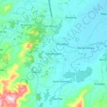
Name: Cabarroguis topographic map, elevation, terrain.

Location: Cabarroguis, Quirino, Cagayan Valley, 3400, Philippines (16.47021 121.48228 16.55021 121.56228)

Average elevation: 515 ft

Minimum elevation: 312 ft

Maximum elevation: 1,522 ft

Gear up for your next adventure:

Backpacking Tents - Weight-optimized shelters for multi-day topographic surveys
🪶Wildlife Field Guides - Learn animal tracking and species ID
🛡️Insect Repellent - Protection against bugs during outdoor activities
🧭Hiking Compass - Precision compass for reliable navigation in the wilderness
🚁Photography Drones - Capture stunning aerial views of landforms and topography

As an Amazon Associate, this site earns from qualifying purchases at no extra cost to you.