Geolocate

Etchison topographic map

Click on the map to display elevation.

About this map

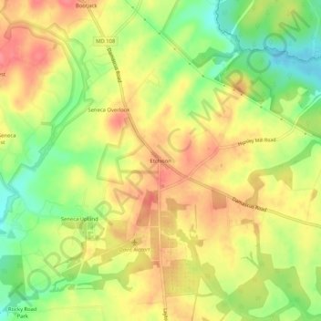
Name: Etchison topographic map, elevation, terrain.

Location: Etchison, Montgomery County, Maryland, 20882, United States (39.23455 -77.16359 39.27455 -77.12359)

Average elevation: 568 ft

Minimum elevation: 436 ft

Maximum elevation: 673 ft

Montgomery County trails, hiking, mountain biking, running and outdoor activities

Gear up for your next adventure:

🛰️Satellite Messengers - Emergency SOS and two-way messaging for off-grid adventures
🧢Outdoor Hiking Hat - Sun protection hat for outdoor explorers
🕶️GPS Smartphone Mount - Secure mount for phone navigation
🛏️Cold Weather Sleeping Bag - Warm sleeping bag for cold conditions
🧭GPS Watch Accessories - Bands and chargers for GPS watches

As an Amazon Associate, this site earns from qualifying purchases at no extra cost to you.