
Make a donation
Gear up for your next adventure:
As an Amazon Associate, this site earns from qualifying purchases at no extra cost to you.
Siefen topographic map
Click on the map to display elevation.
Make a donation
Gear up for your next adventure:
As an Amazon Associate, this site earns from qualifying purchases at no extra cost to you.
Siefen
Die Topographia Ducatus Montani des Erich Philipp Ploennies, Blatt Amt Steinbach, belegt, dass der Wohnplatz bereits 1715 zwei Hofstellen besaß, die als Siefen beschriftet sind. Carl Friedrich von Wiebeking benennt die Hofschaft auf seiner Charte des Herzogthums Berg 1789 als Siefen. Aus ihr geht hervor, dass der Ort zu dieser Zeit Teil der Honschaft Miebach im Kirchspiel Overath war.
Make a donation
Gear up for your next adventure:
As an Amazon Associate, this site earns from qualifying purchases at no extra cost to you.
About this map
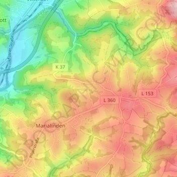
Name: Siefen topographic map, elevation, terrain.
Average elevation: 673 ft
Minimum elevation: 308 ft
Maximum elevation: 1,010 ft
Make a donation
Gear up for your next adventure:
As an Amazon Associate, this site earns from qualifying purchases at no extra cost to you.