Geolocate

Laidley topographic map

Click on the map to display elevation.

About this map

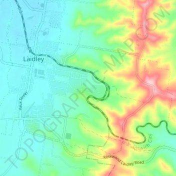
Name: Laidley topographic map, elevation, terrain.

Location: Laidley, Lockyer Valley Regional, Queensland, Australia (-27.66059 152.38122 -27.61909 152.44262)

Average elevation: 499 ft

Minimum elevation: 308 ft

Maximum elevation: 951 ft

Gear up for your next adventure:

🌡️Portable Weather Meter - Track weather conditions on the trail
🧭Pro Hiking Compasses - High-accuracy liquid-filled compasses for topographic orientation
⛑️Personal Locator Beacon - Safety beacon for emergencies
🧤Tactile Hiking Gloves - Keep hands warm while operating GPS and smartphone screens
🦶Carbon Trekking Poles - Reduce knee impact on steep descents with ultra-light poles

As an Amazon Associate, this site earns from qualifying purchases at no extra cost to you.