Geolocate

Burham topographic map

Click on the map to display elevation.

About this map

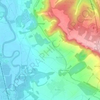
Name: Burham topographic map, elevation, terrain.

Location: Burham, Tonbridge and Malling, Kent, England, United Kingdom (51.31821 0.45073 51.34453 0.50570)

Average elevation: 190 ft

Minimum elevation: -3 ft

Maximum elevation: 614 ft

Gear up for your next adventure:

🔦LED Headlamp - Bright and durable LED headlamp for night navigation
🪶Trail Camera - Capture wildlife on your hikes
🔭Stargazing Telescopes - Perfect for camping in low-light pollution areas shown on maps
🦶Carbon Trekking Poles - Reduce knee impact on steep descents with ultra-light poles
🎒Waterproof Dry Bags - Keep your electronics and maps dry inside your pack

As an Amazon Associate, this site earns from qualifying purchases at no extra cost to you.