Geolocate

Llanbedrog topographic map

Click on the map to display elevation.

About this map

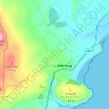
Name: Llanbedrog topographic map, elevation, terrain.

Location: Llanbedrog, Gwynedd, Wales, United Kingdom (52.84344 -4.51808 52.88189 -4.45645)

Average elevation: 190 ft

Minimum elevation: -3 ft

Maximum elevation: 725 ft

Gear up for your next adventure:

💧Water Filtration Bottles - Safely drink from streams and lakes while exploring
🪶Camping Sleeping Pad - Comfortable sleeping pad for backpacking
📡Handheld GPS Device - Reliable handheld GPS for outdoor navigation
Backpacking Tent - Lightweight and durable tent for multi‑day hikes
🌡️Portable Weather Meter - Track weather conditions on the trail

As an Amazon Associate, this site earns from qualifying purchases at no extra cost to you.