
Krimpenerwaard topographic map
Interactive map
Click on the map to display elevation.
About this map
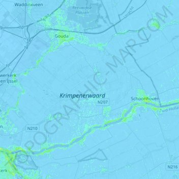
Name: Krimpenerwaard topographic map, elevation, terrain.
Location: Krimpenerwaard, Zuid-Holland, Nederland (51.88935 4.57633 52.02227 4.87779)
Average elevation: -3 ft
Minimum elevation: -26 ft
Maximum elevation: 36 ft
Other topographic maps
Click on a map to view its topography, its elevation and its terrain.
Gouderak
Nederland > Zuid-Holland > Krimpenerwaard
Gouderak, Krimpenerwaard, Zuid-Holland, Nederland
Average elevation: -7 ft