Geolocate

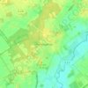
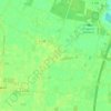
Wettrup topographic map

Click on the map to display elevation.

About this map

Name: Wettrup topographic map, elevation, terrain.

Location: Wettrup, Samtgemeinde Lengerich, Landkreis Emsland, Nedersaksen, Duitsland (52.57240 7.54409 52.61685 7.62265)

Average elevation: 82 ft

Minimum elevation: 62 ft

Maximum elevation: 125 ft

Other topographic maps

Click on a map to view its topography, its elevation and its terrain.
Sustrum-Moor

Duitsland > Nedersaksen > Landkreis Emsland

Average elevation: 36 ft

Gleesen

Duitsland > Nedersaksen > Landkreis Emsland

Average elevation: 95 ft

Neusustrum

Duitsland > Nedersaksen > Landkreis Emsland

Average elevation: 36 ft

Hesselte

Duitsland > Nedersaksen > Landkreis Emsland > Emsbüren

Average elevation: 102 ft

Baccum

Duitsland > Nedersaksen > Landkreis Emsland > Lingen (Ems)

Average elevation: 138 ft

Ramsel

Duitsland > Nedersaksen > Landkreis Emsland > Lingen (Ems)

Average elevation: 128 ft

Sprakel

Duitsland > Nedersaksen > Landkreis Emsland > Stavern

Average elevation: 128 ft

Sand

Duitsland > Nedersaksen > Landkreis Emsland > Oberlangen

Average elevation: 33 ft

Haar

Duitsland > Nedersaksen > Landkreis Emsland > Haren (Ems)

Average elevation: 49 ft

Gear up for your next adventure:

🔥Fast-Boil Camping Stoves - Efficient cooking systems for quick trail meals
📻Weather Alert Radios - Stay informed of storm risks while off-the-grid
🧼Biodegradable Camping Soap - Eco‑friendly soap for outdoor hygiene
🧺Microfiber Travel Towels - Compact and fast-drying towels for trail use
🧦Merino Wool Socks - Moisture-wicking, blister-preventing socks for long treks

As an Amazon Associate, this site earns from qualifying purchases at no extra cost to you.