Geolocate

Paolbo topographic map

Click on the map to display elevation.

About this map

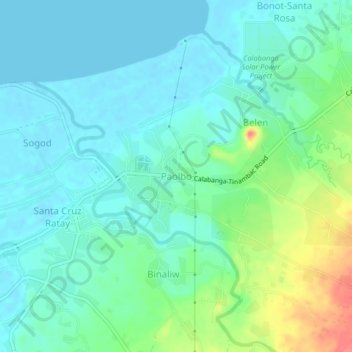
Name: Paolbo topographic map, elevation, terrain.

Location: Paolbo, Camarines Sur, Bicol Region, 4405, Philippines (13.69779 123.22045 13.73779 123.26045)

Average elevation: 52 ft

Minimum elevation: -3 ft

Maximum elevation: 207 ft

Other topographic maps

Click on a map to view its topography, its elevation and its terrain.

Del Gallego

Philippines > Camarines Sur

Average elevation: 299 ft

Sagñay

Philippines > Camarines Sur

Average elevation: 535 ft

Caramoan

Philippines > Camarines Sur

Average elevation: 138 ft

Gear up for your next adventure:

📡Handheld GPS Device - Reliable handheld GPS for outdoor navigation
🪶Trail Camera - Capture wildlife on your hikes
🪶LED Camping Lantern - Bright lantern for camp lighting
😴Insulated Sleeping Pads - Compact and warm pads for high-elevation camping
🪵Folding Camp Saw - Compact saw for wood and campsite work

As an Amazon Associate, this site earns from qualifying purchases at no extra cost to you.