Geolocate

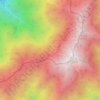
Hofu topographic map

Click on the map to display elevation.

About this map

Name: Hofu topographic map, elevation, terrain.

Location: Hofu, Yamaguchi Prefecture, Japan (33.82342 131.45524 34.16048 131.75407)

Average elevation: 164 ft

Minimum elevation: -16 ft

Maximum elevation: 1,998 ft

Other topographic maps

Click on a map to view its topography, its elevation and its terrain.
Osaka Prefecture

Japan

Average elevation: 617 ft

300M

Japan > Nagasaki

Average elevation: 722 ft

Takeda Castle

Japan > Asago

Average elevation: 571 ft

Akaishi Mountains

Japan > Oshika

Average elevation: 8,501 ft

Iwo to

Japan > Tokyo > Ogasawara

Average elevation: 0 ft

葭町

Japan > Matsumoto

Average elevation: 2,021 ft

Nishikigaoka-chuo Park

Japan > Sendai

Average elevation: 646 ft

Nakauonuma County

Japan

Average elevation: 1,985 ft

Mount Yatsugatake viewpoint

Japan > Suwa County > Fujimi

Average elevation: 5,715 ft

Gear up for your next adventure:

👓Polarized Sunglasses - Outdoor sunglasses for glare reduction
🛏️Cold Weather Sleeping Bag - Warm sleeping bag for cold conditions
📦Dry Bags Set - Waterproof storage for electronics and clothes
🧤Hiking Gloves - Protective gloves for rugged trails
🎒Trail Energy Bars - High‑calorie bars for hiking energy

As an Amazon Associate, this site earns from qualifying purchases at no extra cost to you.