
Thank you for supporting this site ❤️
Make a donation
Make a donation
Gear up for your next adventure:
As an Amazon Associate, this site earns from qualifying purchases at no extra cost to you.
Puija topographic map
Click on the map to display elevation.
Thank you for supporting this site ❤️
Make a donation
Make a donation
Gear up for your next adventure:
As an Amazon Associate, this site earns from qualifying purchases at no extra cost to you.
About this map
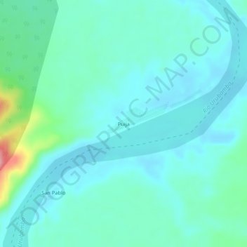
Name: Puija topographic map, elevation, terrain.
Location: Puija, Sepahua, Atalaya, Ucayali, Perú (-11.05770 -73.10726 -11.01770 -73.06726)
Average elevation: 915 ft
Minimum elevation: 843 ft
Maximum elevation: 1,260 ft
Thank you for supporting this site ❤️
Make a donation
Make a donation
Gear up for your next adventure:
As an Amazon Associate, this site earns from qualifying purchases at no extra cost to you.