Geolocate

Pukekohe topographic map

Click on the map to display elevation.

About this map

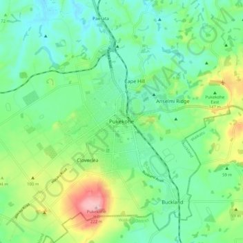
Name: Pukekohe topographic map, elevation, terrain.

Location: Pukekohe, Franklin, Auckland, 2120, New Zealand (-37.24064 174.86369 -37.16064 174.94369)

Average elevation: 256 ft

Minimum elevation: 59 ft

Maximum elevation: 735 ft

Gear up for your next adventure:

🛠️Outdoor Gear Repair Kit - Essential tools to fix gear on the trail
📶Vehicle Signal Boosters - Improve reception in rural areas while driving to trailheads
🪑Ultralight Camp Chairs - Portable seating for resting after a long day of mapping
📦Gear Storage Bags - Organize and protect outdoor equipment
🗻Climbing Gear Basics - Essential gear for beginner climbers

As an Amazon Associate, this site earns from qualifying purchases at no extra cost to you.