Geolocate

Calgary topographic map

Click on the map to display elevation.

About this map

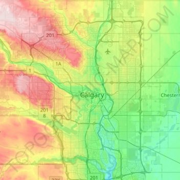
Name: Calgary topographic map, elevation, terrain.

Location: Calgary, Alberta, T2G 0B1, Canada (50.89342 -114.22259 51.21342 -113.90259)

Average elevation: 3,629 ft

Minimum elevation: 3,271 ft

Maximum elevation: 4,318 ft

Other topographic maps

Click on a map to view its topography, its elevation and its terrain.

Sien Lok Park

Canada > Alberta > Calgary

Average elevation: 3,481 ft

Gear up for your next adventure:

👟Men's Trail Runners - Lightweight footwear for fast-paced exploration and light hiking
📦Dry Bags Set - Waterproof storage for electronics and clothes
🩳Quick‑Dry Hiking Shorts - Comfortable and quick‑dry shorts for summer hiking
🔪Outdoor Multitools - Essential survival tools for gear repair and field use
🥇GPS Hiking Watch - Multi‑sport GPS watch with navigation and trail tracking

As an Amazon Associate, this site earns from qualifying purchases at no extra cost to you.