
Thank you for supporting this site ❤️
Make a donation
Make a donation
Gear up for your next adventure:
As an Amazon Associate, this site earns from qualifying purchases at no extra cost to you.
Olongapo topographic map
Click on the map to display elevation.
Thank you for supporting this site ❤️
Make a donation
Make a donation
Gear up for your next adventure:
As an Amazon Associate, this site earns from qualifying purchases at no extra cost to you.
About this map
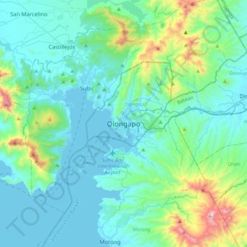
Name: Olongapo topographic map, elevation, terrain.
Location: Olongapo, Zambales, Central Luzon, 2200, Philippines (14.67147 120.12352 14.99147 120.44352)
Average elevation: 636 ft
Minimum elevation: -10 ft
Maximum elevation: 4,055 ft
Thank you for supporting this site ❤️
Make a donation
Make a donation
Gear up for your next adventure:
As an Amazon Associate, this site earns from qualifying purchases at no extra cost to you.