Geolocate

Bracken Ridge topographic map

Click on the map to display elevation.

About this map

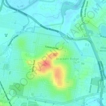
Name: Bracken Ridge topographic map, elevation, terrain.

Location: Bracken Ridge, City of Brisbane, Queensland, Australia (-27.33286 153.01368 -27.30145 153.05086)

Average elevation: 43 ft

Minimum elevation: -3 ft

Maximum elevation: 177 ft

Other topographic maps

Click on a map to view its topography, its elevation and its terrain.

Enoggera Hill

Australia > Queensland > City of Brisbane

Average elevation: 374 ft

Toohey Mountain

Australia > Queensland > City of Brisbane

Average elevation: 174 ft

Blunder Creek

Australia > Queensland > City of Brisbane

Average elevation: 85 ft

Tangalooma

Australia > Queensland > City of Brisbane

Average elevation: 135 ft

Timberland Park

Australia > Queensland > City of Brisbane

Average elevation: 121 ft

Deepwater Bend

Australia > Queensland > City of Brisbane

Average elevation: 16 ft

Tangalooma

Australia > Queensland > City of Brisbane

Average elevation: 135 ft

Gear up for your next adventure:

🧣Hiking Neck Gaiter - Multi‑use neck protection for outdoor weather
🪶Thermal Camp Blanket - Extra warmth for cold nights
🔦Compact Flashlight - Reliable flashlight for emergencies
🪶Trail Camera - Capture wildlife on your hikes
🥾Hiking Shoes - Durable and comfortable shoes for trail hiking

As an Amazon Associate, this site earns from qualifying purchases at no extra cost to you.