Geolocate

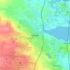
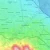
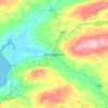
Feakle topographic map

Click on the map to display elevation.

About this map

Name: Feakle topographic map, elevation, terrain.

Location: Feakle, Killaloe Municipal District, County Clare, Munster, Ireland (52.90763 -8.65683 52.97772 -8.58970)

Average elevation: 315 ft

Minimum elevation: 105 ft

Maximum elevation: 892 ft

Other topographic maps

Click on a map to view its topography, its elevation and its terrain.
Cork

Ireland > County Cork > Cork

Average elevation: 308 ft

Swords

Ireland > County Dublin > Swords

The medieval town developed in a linear pattern along Main Street, in a roughly north-south direction. Swords has one of the best examples of this settlement pattern in the Dublin region. The round tower, 26m in height, is also an indicator of early Christian settlement. The Irish high king Brian Boru is said…

Average elevation: 92 ft
Athlone

Ireland > County Westmeath > Athlone

Average elevation: 144 ft

River Shannon

Ireland

Average elevation: 128 ft

Bolus Head

Ireland

Average elevation: 92 ft
Downeen Point

Ireland

Average elevation: 36 ft

Cromane

Ireland

Average elevation: 10 ft

Maghera Strand

Ireland

Average elevation: 121 ft

Knockdrin

Ireland

Average elevation: 315 ft

Ballycurry

Ireland

Average elevation: 584 ft

Ballyedmond

Ireland

Average elevation: 240 ft

Furry Glen

Ireland

Average elevation: 144 ft

Trout Lake

Ireland

Average elevation: 266 ft

Tory Hill

Ireland

Average elevation: 430 ft

Dowth

Ireland

Average elevation: 105 ft

Great Skellig

Ireland

Average elevation: 3 ft

Spinans Hill

Ireland

Average elevation: 801 ft

Gaulstown Castle

Ireland

Average elevation: 594 ft

Skeaghvasteen

Ireland

Average elevation: 318 ft

Tibberaghny Castle

Ireland

Average elevation: 59 ft

Myles Big Stone

Ireland

Average elevation: 292 ft

Kilkee Cliffs

Ireland

Average elevation: 62 ft

Dunlicky Point

Ireland

Average elevation: 59 ft

Doulus Head

Ireland

Average elevation: 52 ft

Galley Head

Ireland

Average elevation: 10 ft

Frower Point

Ireland

Average elevation: 66 ft

Knockadoon Head

Ireland

Average elevation: 20 ft

Mine Head

Ireland

Average elevation: 72 ft

Glendoo Mountain

Ireland

Average elevation: 1,575 ft

Crohy Head Sea Arch

Ireland

Average elevation: 92 ft

Dawros Bay

Ireland

Average elevation: 20 ft

Portacloy Bay

Ireland

Average elevation: 187 ft

Mace Head

Ireland

Average elevation: 10 ft

Doonbeg Head

Ireland

Average elevation: 105 ft

Lambs Head Bay

Ireland

Average elevation: 46 ft

Clifden Bay

Ireland

Average elevation: 135 ft

Galway Bay

Ireland

Average elevation: 0 ft

Dollymount

Ireland

Average elevation: 20 ft

Bailieborough

Ireland > County Cavan > Bailieborough

Average elevation: 554 ft

Castletownroche

Ireland > County Cork

Average elevation: 220 ft

Ballinacourty

Ireland > County Waterford

Average elevation: 10 ft

Ennis

Ireland > County Clare > Ennis

Average elevation: 66 ft

Galway City

Ireland > Galway City

Average elevation: 85 ft

Aughagower

Ireland > County Mayo > Aughagower

Average elevation: 230 ft

Ballincollig

Ireland > County Cork > Cork

Average elevation: 203 ft

Knocksink Wood

Ireland > County Wicklow

Average elevation: 574 ft

Drogheda

Ireland > County Louth > Drogheda

Average elevation: 125 ft

Mallow

Ireland > County Cork > Mallow

Average elevation: 348 ft

Dundrum

Ireland > County Dublin

Average elevation: 259 ft

Howth

Ireland > County Dublin

Average elevation: 26 ft

Lucan

Ireland > County Dublin

Average elevation: 194 ft

Malahide

Ireland > County Dublin > Malahide

Average elevation: 33 ft

Walton's Bog

Ireland > County Kilkenny

Average elevation: 217 ft

Meelin

Ireland > County Cork

Average elevation: 807 ft

Caherlistrane

Ireland > County Galway

Average elevation: 121 ft

Carrauntoohil

Ireland > County Kerry

Carrauntoohil is the highest mountain in Ireland on all classification scales. It is the 133rd-highest mountain, and 4th most prominent mountain, in Britain and Ireland, on the Simms classification. Carrauntoohil is regarded by the Scottish Mountaineering Club (SMC) as one of 34 Furths, which are defined as…

Average elevation: 2,113 ft

Claureen River

Ireland > County Clare

Average elevation: 46 ft

Mountbellew

Ireland > County Galway

Average elevation: 226 ft

Upper Glanmire Bridge

Ireland > County Cork > Cork

Average elevation: 295 ft

Glandore

Ireland > County Cork

Average elevation: 184 ft

Belpere Cross

Ireland > County Meath

Average elevation: 364 ft

Doolin Cave

Ireland > County Clare

Average elevation: 285 ft

Slane

Ireland > County Meath > Slane

Average elevation: 223 ft

Kilternan

Ireland > County Dublin

Average elevation: 568 ft

White Strand Beach

Ireland > Knightstown

Average elevation: 26 ft

Kildare Round Tower

Ireland > County Kildare

A Topographical Dictionary of Ireland states "One of the ancient round towers stood here till 1807 when it was pulled down to make room for the belfry of the church".

Average elevation: 328 ft

Old Kilcullen

Ireland > County Kildare > Old Kilcullen

Average elevation: 410 ft

Firies

Ireland > County Kerry

Average elevation: 102 ft

Ballyedmond

Ireland > County Wexford

Average elevation: 243 ft

Old Head of Kinsale

Ireland > County Cork

Average elevation: 16 ft

Knocknatulla

Ireland > County Meath > Knocknatulla

Average elevation: 249 ft

Rattoo Round Tower

Ireland > County Kerry

Average elevation: 52 ft

High Island

Ireland > County Galway

Average elevation: 3 ft

Bealaha

Ireland > County Clare

Average elevation: 56 ft

Staigue Fort

Ireland > County Kerry

Average elevation: 627 ft

Ennistimon

Ireland > County Clare > Ennistimon

Average elevation: 200 ft

Kells Round Tower

Ireland > County Meath

Average elevation: 226 ft

Kerry Pike

Ireland > County Cork > Cork

Average elevation: 180 ft

Lough Bunny

Ireland > County Clare

Average elevation: 75 ft

Errina Canal

Ireland > County Clare

Average elevation: 36 ft

Upperchurch

Ireland > County Tipperary

Average elevation: 758 ft

Lisgoold

Ireland > County Cork

Average elevation: 367 ft

Mahon Falls

Ireland > County Waterford

Average elevation: 1,886 ft

Glinsk

Ireland > County Mayo

Average elevation: 381 ft

Staleen Lock - Lock 3

Ireland > County Meath

Average elevation: 164 ft

Feakle

Ireland > County Clare

Average elevation: 358 ft

Pollduff

Ireland > County Galway

Average elevation: 719 ft

Gurteen

Ireland > County Galway

Average elevation: 292 ft

Menlough

Ireland > County Galway

Average elevation: 295 ft

Iveagh Gardens

Ireland > County Dublin > Dublin

Average elevation: 56 ft

Knock

Ireland > County Tipperary

Average elevation: 423 ft

Tinryland

Ireland > County Carlow

Average elevation: 236 ft

Louth

Ireland > County Louth

Average elevation: 112 ft

Rathcairn

Ireland > County Meath

Average elevation: 253 ft
Finsboro

Ireland > County Kilkenny

Average elevation: 535 ft
Ballynacarrow

Ireland > County Sligo

Average elevation: 236 ft

Cornelscourt

Ireland > County Dublin

Average elevation: 194 ft

Hollyford

Ireland > County Tipperary

Average elevation: 925 ft

Gear up for your next adventure:

🧣Merino Neck Gaiters - Multi-functional headwear for wind and sun protection
🥤Water Filter Bottle - All‑in‑one filter bottle for safe hydration
🔊Portable Camp Speaker - Music and alerts at camp
🥄Camping Utensil Set - Lightweight utensils for outdoor meals
⛑️Personal Locator Beacon - Safety beacon for emergencies

As an Amazon Associate, this site earns from qualifying purchases at no extra cost to you.