
Goba topographic map
Interactive map
Click on the map to display elevation.
About this map
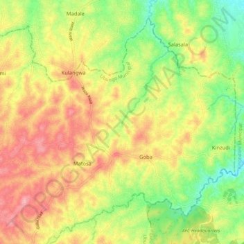
Name: Goba topographic map, elevation, terrain.
Location: Goba, Ubungo Municipal, Dar es-Salaam, Coastal Zone, Tanzania (-6.76541 39.10584 -6.69033 39.19408)
Average elevation: 361 ft
Minimum elevation: 131 ft
Maximum elevation: 584 ft
Other topographic maps
Click on a map to view its topography, its elevation and its terrain.