
Thank you for supporting this site ❤️
Make a donation
Make a donation
Gear up for your next adventure:
As an Amazon Associate, this site earns from qualifying purchases at no extra cost to you.
Patalsu Peak topographic map
Click on the map to display elevation.
Thank you for supporting this site ❤️
Make a donation
Make a donation
Gear up for your next adventure:
As an Amazon Associate, this site earns from qualifying purchases at no extra cost to you.
About this map
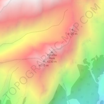
Name: Patalsu Peak topographic map, elevation, terrain.
Location: Patalsu Peak, Manali, Kullu, Himachal Pradesh, India (32.35392 77.19084 32.35402 77.19094)
Average elevation: 12,310 ft
Minimum elevation: 9,459 ft
Maximum elevation: 14,364 ft
Thank you for supporting this site ❤️
Make a donation
Make a donation
Gear up for your next adventure:
As an Amazon Associate, this site earns from qualifying purchases at no extra cost to you.