Geolocate

Tug Hill topographic map

Click on the map to display elevation.

Tug Hill

The core Tug Hill region encompasses 150,000 acres (610 km2) of unbroken, generally second-growth, northern hardwood forest, and is drained by a vast network of streams. Important rivers and streams whose headwaters are located within the Tug Hill region include the Mohawk River, Deer River, Salmon River, Mad River, Sandy Creek, and the east and west branches of Fish Creek. Despite the presence of numerous streams, many of the soils in the regions' core are poorly drained. Almost all the soils have some combination of factors which render them unsuitable for agriculture, including shallow depth, stoniness, rough topography, poor or excessive drainage, strong acidity and/or low fertility. Agricultural activity is largely absent from the Tug Hill's core, and is concentrated mainly in the outlying northern and western portions of the region, where soils are better drained and more fertile.

Wikipedia (CC-BY-SA 3.0)

About this map

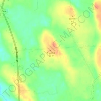
Name: Tug Hill topographic map, elevation, terrain.

Location: Tug Hill, Town of Oswego, Oswego County, New York, United States (43.39835 -76.56083 43.39845 -76.56073)

Average elevation: 358 ft

Minimum elevation: 292 ft

Maximum elevation: 423 ft

Oswego County trails, hiking, mountain biking, running and outdoor activities

Other topographic maps

Click on a map to view its topography, its elevation and its terrain.

Town of New Haven

United States > New York > Oswego County

Average elevation: 374 ft

Town of Richland

United States > New York > Oswego County

Average elevation: 584 ft

Village of Parish

United States > New York > Oswego County

Average elevation: 482 ft

Village of Mexico

United States > New York > Oswego County

Average elevation: 384 ft

Town of Scriba

United States > New York > Oswego County

Average elevation: 344 ft

Town of Oswego

United States > New York > Oswego County

Average elevation: 318 ft

Town of Scriba

United States > New York > Oswego County

Average elevation: 344 ft

Town of Redfield

United States > New York > Oswego County

Average elevation: 1,296 ft

City of Fulton

United States > New York > Oswego County

Average elevation: 374 ft

City of Fulton

United States > New York > Oswego County

Average elevation: 374 ft

Town of Mexico

United States > New York > Oswego County

Average elevation: 390 ft

Altmar

United States > New York > Oswego County

Average elevation: 574 ft

Town of Orwell

United States > New York > Oswego County

Average elevation: 745 ft

Town of Mexico

United States > New York > Oswego County

Average elevation: 390 ft

Town of Granby

United States > New York > Oswego County

Average elevation: 410 ft

Gear up for your next adventure:

🌐World Map Poster - Decorative world maps with topographic info
🧦Merino Wool Socks - Moisture-wicking, blister-preventing socks for long treks
🔭Compact Binoculars - HD vision for scouting terrain and identifying distant landmarks
🧥Waterproof Jacket for Hiking - Breathable and rugged rain jacket for outdoor excursions
🔦Powerful Headlamps - Ultra-bright hands-free lighting for night navigation

As an Amazon Associate, this site earns from qualifying purchases at no extra cost to you.