
Thank you for supporting this site ❤️
Make a donation
Make a donation
Gear up for your next adventure:
As an Amazon Associate, this site earns from qualifying purchases at no extra cost to you.
Bohonal topographic map
Click on the map to display elevation.
Thank you for supporting this site ❤️
Make a donation
Make a donation
Gear up for your next adventure:
As an Amazon Associate, this site earns from qualifying purchases at no extra cost to you.
About this map
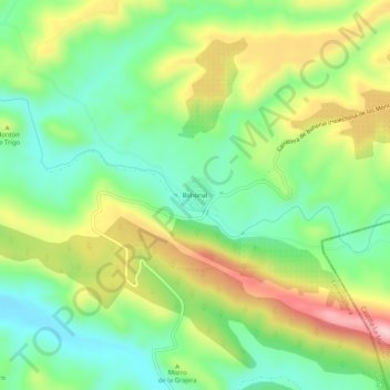
Name: Bohonal topographic map, elevation, terrain.
Location: Bohonal, Helechosa de los Montes, Badajoz, Extremadura, España (39.30550 -4.79783 39.34550 -4.75783)
Average elevation: 1,736 ft
Minimum elevation: 1,407 ft
Maximum elevation: 2,247 ft
Thank you for supporting this site ❤️
Make a donation
Make a donation
Gear up for your next adventure:
As an Amazon Associate, this site earns from qualifying purchases at no extra cost to you.