
Belen topographic map
Click on the map to display elevation.
About this map
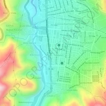
Name: Belen topographic map, elevation, terrain.
Location: Belen, Vista Alegre, Huaraz, Áncash, Perú, Parque Santa Rosa (-9.53238 -77.53156 -9.53159 -77.53119)
Average elevation: 10,207 ft
Minimum elevation: 9,843 ft
Maximum elevation: 10,883 ft