
Cowichan River topographic map
Interactive map
Click on the map to display elevation.
About this map
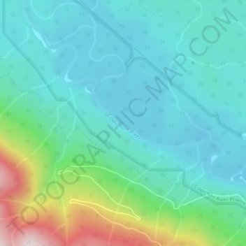
Name: Cowichan River topographic map, elevation, terrain.
Average elevation: 820 ft
Minimum elevation: 390 ft
Maximum elevation: 2,352 ft
Other topographic maps
Click on a map to view its topography, its elevation and its terrain.
Carmanah Walbran Provincial Park
Canada > British Columbia > Area F (Cowichan Lake South / Skutz Falls)
Carmanah Walbran Provincial Park, Area F (Cowichan Lake South / Skutz Falls), Cowichan Valley Regional District, British Columbia, Canada
Average elevation: 1,198 ft
Josiah Creek
Canada > British Columbia > Area F (Cowichan Lake South / Skutz Falls)
Josiah Creek, Area F (Cowichan Lake South / Skutz Falls), Cowichan Valley Regional District, British Columbia, V0R 2G0, Canada
Average elevation: 722 ft