Geolocate

Tacunan topographic map

Click on the map to display elevation.

About this map

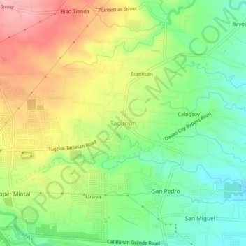
Name: Tacunan topographic map, elevation, terrain.

Location: Tacunan, Davao City, Davao Region, 8022, Philippines (7.09364 125.49694 7.13364 125.53694)

Average elevation: 453 ft

Minimum elevation: 240 ft

Maximum elevation: 725 ft

Other topographic maps

Click on a map to view its topography, its elevation and its terrain.

Tamayong

Philippines > Davao City

Average elevation: 2,552 ft

Baguio District

Philippines > Davao City

Average elevation: 1,847 ft

Matina River

Philippines > Davao City > Matina Pangi

Average elevation: 203 ft

75-A Matina Aplaya

Philippines > Davao City

Average elevation: 10 ft

26-C Silangan

Philippines > Davao City

Average elevation: 13 ft

Lipadas River

Philippines > Davao City

Average elevation: 4,432 ft

Maa Creek

Philippines > Davao City

Average elevation: 131 ft

Matina Pangi

Philippines > Davao City

Average elevation: 174 ft

Ogdoy River

Philippines > Davao City

Average elevation: 433 ft

Mapula River

Philippines > Davao City

Average elevation: 1,467 ft

Ma-a

Philippines > Davao City

Average elevation: 118 ft

Wilfredo Aquino

Philippines > Davao City

Average elevation: 33 ft

Gear up for your next adventure:

🧯Emergency Survival Kit - All‑in‑one survival essentials for the backcountry
🦺Reflective Outdoor Gear - Safety gear for low‑light conditions
📦Gear Storage Bags - Organize and protect outdoor equipment
🗺️Topographic Maps - Detailed topo maps for hiking, exploring and outdoor navigation
🧤Hiking Gloves - Protective gloves for rugged trails

As an Amazon Associate, this site earns from qualifying purchases at no extra cost to you.