Geolocate

Gusa topographic map

Click on the map to display elevation.

About this map

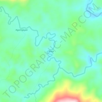
Name: Gusa topographic map, elevation, terrain.

Location: Gusa, San Jose de Buan, Samar, Eastern Visayas, Philippines (12.08797 125.03199 12.12797 125.07199)

Average elevation: 728 ft

Minimum elevation: 459 ft

Maximum elevation: 1,539 ft

Gear up for your next adventure:

🌡️Handheld Weather Meters - Measure wind, temp, and pressure for safe mountain travel
🛰️Satellite Messengers - Emergency SOS and two-way messaging for off-grid adventures
🧭Orienteering Set - Complete compass and map reading kit
🧭GPS Watch Accessories - Bands and chargers for GPS watches
🧣Hiking Neck Gaiter - Multi‑use neck protection for outdoor weather

As an Amazon Associate, this site earns from qualifying purchases at no extra cost to you.