
Villarly topographic map
Click on the map to display elevation.
About this map
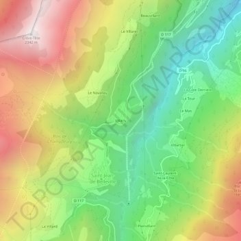
Name: Villarly topographic map, elevation, terrain.
Average elevation: 4,337 ft
Minimum elevation: 1,814 ft
Maximum elevation: 7,602 ft
Other topographic maps
Click on a map to view its topography, its elevation and its terrain.
Saint-Jean-de-Belleville
France > Auvergne-Rhône-Alpes > Savoy > Les Belleville
Average elevation: 5,925 ft
Saint-Jean-de-Belleville
France > Auvergne-Rhône-Alpes > Savoy > Les Belleville
Average elevation: 5,925 ft