
Beans topographic map
Click on the map to display elevation.
About this map
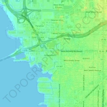
Name: Beans topographic map, elevation, terrain.
Average elevation: 23 ft
Minimum elevation: -3 ft
Maximum elevation: 49 ft
Hillsborough County trails, hiking, mountain biking, running and outdoor activities
Other topographic maps
Click on a map to view its topography, its elevation and its terrain.
City of Tampa Waterworks Dam
United States > Florida > Hillsborough County > Tampa > Altos Verdes
Average elevation: 43 ft