
Thank you for supporting this site ❤️
Make a donation
Make a donation
Gear up for your next adventure:
As an Amazon Associate, this site earns from qualifying purchases at no extra cost to you.
Ban Khok Sa-at topographic map
Click on the map to display elevation.
Thank you for supporting this site ❤️
Make a donation
Make a donation
Gear up for your next adventure:
As an Amazon Associate, this site earns from qualifying purchases at no extra cost to you.
About this map
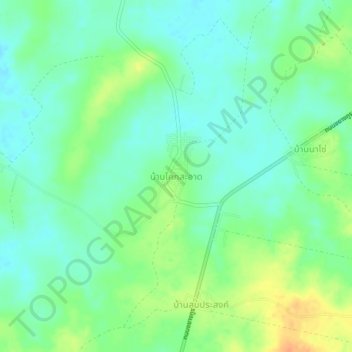
Name: Ban Khok Sa-at topographic map, elevation, terrain.
Location: Ban Khok Sa-at, Nong Loeng, Bueng Kan Province, Thailand (18.36958 103.31803 18.40958 103.35803)
Average elevation: 541 ft
Minimum elevation: 495 ft
Maximum elevation: 623 ft
Thank you for supporting this site ❤️
Make a donation
Make a donation
Gear up for your next adventure:
As an Amazon Associate, this site earns from qualifying purchases at no extra cost to you.