Geolocate

Nouadhibou topographic map

Click on the map to display elevation.

About this map

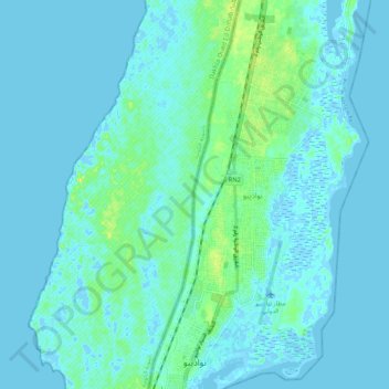
Name: Nouadhibou topographic map, elevation, terrain.

Location: Nouadhibou, Dakhlet Nouadhibou, Mauritania (20.90587 -17.05934 21.00378 -17.01556)

Average elevation: 13 ft

Minimum elevation: -26 ft

Maximum elevation: 85 ft

Gear up for your next adventure:

🌡️Handheld Weather Meters - Measure wind, temp, and pressure for safe mountain travel
⛑️Personal Locator Beacon - Safety beacon for emergencies
🔌USB Car Charger - Car charger for on‑the‑go power needs
🗃️Trail First Aid Kit - Essential kit for outdoor injuries and emergencies
🌧️Backpack Rain Cover - Keep gear dry in wet weather

As an Amazon Associate, this site earns from qualifying purchases at no extra cost to you.