Geolocate

Anis topographic map

Click on the map to display elevation.

About this map

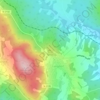
Name: Anis topographic map, elevation, terrain.

Location: Anis, Langdorf, Landkreis Regen, Bayern, 94264, Deutschland (49.01766 13.14422 49.01776 13.14432)

Average elevation: 2,156 ft

Minimum elevation: 1,854 ft

Maximum elevation: 2,703 ft

Gear up for your next adventure:

🎒Trekking Poles - Sturdy poles for balance and stability on rough terrain
🧢Outdoor Hiking Hat - Sun protection hat for outdoor explorers
🪶LED Camping Lantern - Bright lantern for camp lighting
👟Trail Running Shoes - Lightweight shoes for trail runners
🔥Plasma Lighters - Windproof lighters that work in any weather condition

As an Amazon Associate, this site earns from qualifying purchases at no extra cost to you.