Nashville topographic map
Interactive map
Click on the map to display elevation.
About this map
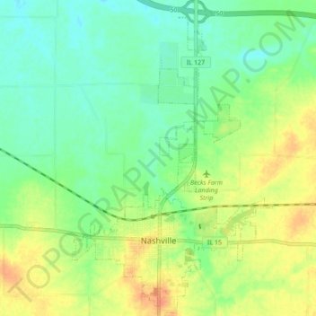
Name: Nashville topographic map, elevation, terrain.
Location: Nashville, Washington County, Illinois, 62263, United States (38.32754 -89.40408 38.39388 -89.35033)
Average elevation: 492 ft
Minimum elevation: 440 ft
Maximum elevation: 564 ft
Other topographic maps
Click on a map to view its topography, its elevation and its terrain.
Richview
United States > Illinois > Washington County
Richview, Washington County, Illinois, United States
Average elevation: 541 ft
Du Bois
United States > Illinois > Washington County
Du Bois, Washington County, Illinois, United States
Average elevation: 525 ft
Okawville
United States > Illinois > Washington County > Okawville
Okawville, Washington County, Illinois, 62271, United States
Average elevation: 443 ft
Irvington
United States > Illinois > Washington County > Irvington
Irvington, Washington County, Illinois, 62848, United States
Average elevation: 531 ft