Geolocate

Cerler topographic map

Click on the map to display elevation.

About this map

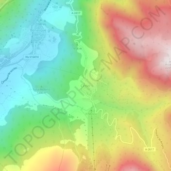
Name: Cerler topographic map, elevation, terrain.

Location: Cerler, Benasque, Ribagorza, Huesca, Aragon, 22449, Spain (42.57274 0.51842 42.61274 0.55842)

Average elevation: 5,253 ft

Minimum elevation: 3,638 ft

Maximum elevation: 7,451 ft

Other topographic maps

Click on a map to view its topography, its elevation and its terrain.

Vallibierna

Spain > Aragon > Benasque

Average elevation: 7,467 ft

Gear up for your next adventure:

🛡️Insect Repellent - Protection against bugs during outdoor activities
Camping Coffee Makers - Enjoy premium coffee at the summit or campsite
📶Vehicle Signal Boosters - Improve reception in rural areas while driving to trailheads
🔭Compact Binoculars - HD vision for scouting terrain and identifying distant landmarks
📌Outdoor GPS Map App - Apps and devices for digital topographic navigation

As an Amazon Associate, this site earns from qualifying purchases at no extra cost to you.