Geolocate

Vallibierna topographic map

Click on the map to display elevation.

About this map

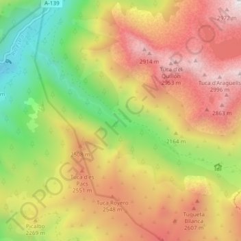
Name: Vallibierna topographic map, elevation, terrain.

Location: Vallibierna, Benasque, Ribagorza, Huesca, Aragon, Spain (42.60456 0.56279 42.63687 0.63640)

Average elevation: 7,467 ft

Minimum elevation: 4,446 ft

Maximum elevation: 10,256 ft

Gear up for your next adventure:

🧣Merino Neck Gaiters - Multi-functional headwear for wind and sun protection
📶Vehicle Signal Boosters - Improve reception in rural areas while driving to trailheads
🌎3D Topographic Globes - Raised relief globes for a tactile understanding of geography
🔭Stargazing Telescopes - Perfect for camping in low-light pollution areas shown on maps
🏔️Mountain Trail Maps - High‑detail maps for popular peaks

As an Amazon Associate, this site earns from qualifying purchases at no extra cost to you.