Geolocate

Towanda topographic map

Click on the map to display elevation.

About this map

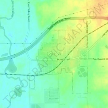
Name: Towanda topographic map, elevation, terrain.

Location: Towanda, Butler County, Kansas, United States (37.78615 -97.00756 37.80837 -96.98728)

Average elevation: 1,289 ft

Minimum elevation: 1,243 ft

Maximum elevation: 1,352 ft

Butler County trails, hiking, mountain biking, running and outdoor activities

Gear up for your next adventure:

📶Satellite Messenger - Communication device off‑grid
🛰️Satellite Messengers - Emergency SOS and two-way messaging for off-grid adventures
🧢Outdoor Hiking Hat - Sun protection hat for outdoor explorers
🪶Camping Sleeping Pad - Comfortable sleeping pad for backpacking
🧭Outdoor Navigation Book - Learn advanced navigation skills

As an Amazon Associate, this site earns from qualifying purchases at no extra cost to you.