
Thank you for supporting this site ❤️
Make a donation
Make a donation
Gear up for your next adventure:
As an Amazon Associate, this site earns from qualifying purchases at no extra cost to you.
Modrava topographic map
Click on the map to display elevation.
Thank you for supporting this site ❤️
Make a donation
Make a donation
Gear up for your next adventure:
As an Amazon Associate, this site earns from qualifying purchases at no extra cost to you.
About this map
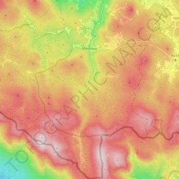
Name: Modrava topographic map, elevation, terrain.
Location: Modrava, okres Klatovy, Plzeňský kraj, Southwest, Czechia (48.94126 13.39945 49.05394 13.55152)
Average elevation: 3,691 ft
Minimum elevation: 2,559 ft
Maximum elevation: 4,518 ft
Thank you for supporting this site ❤️
Make a donation
Make a donation
Gear up for your next adventure:
As an Amazon Associate, this site earns from qualifying purchases at no extra cost to you.