
Salisbury topographic map
Click on the map to display elevation.
About this map
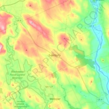
Name: Salisbury topographic map, elevation, terrain.
Average elevation: 636 ft
Minimum elevation: 249 ft
Maximum elevation: 1,207 ft
Merrimack County trails, hiking, mountain biking, running and outdoor activities
Other topographic maps
Click on a map to view its topography, its elevation and its terrain.
Salisbury Heights
United States > New Hampshire > Merrimack County > Salisbury > Salisbury Heights
Average elevation: 804 ft