Geolocate

El Cocuy topographic map

Click on the map to display elevation.

About this map

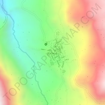
Name: El Cocuy topographic map, elevation, terrain.

Location: El Cocuy, Gutiérrez, Boyacá, Región Andina, 151280, Colombia (6.40219 -72.44776 6.41355 -72.44184)

Average elevation: 9,117 ft

Minimum elevation: 7,828 ft

Maximum elevation: 10,518 ft

Gear up for your next adventure:

📌Outdoor GPS Map App - Apps and devices for digital topographic navigation
🪑Portable Camp Table - Compact table for campsite meals
🪶Paracord Bracelet - Survival bracelet with built‑in tools
🥾Hiking Shoes - Durable and comfortable shoes for trail hiking
🍳Camping Cook Set - Complete cookware for outdoor meals

As an Amazon Associate, this site earns from qualifying purchases at no extra cost to you.