Geolocate

Llanas topographic map

Click on the map to display elevation.

About this map

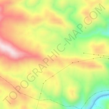
Name: Llanas topographic map, elevation, terrain.

Location: Llanas, El Real de la Jara, Sevilla, Andalusia, Spain (37.91063 -5.97247 37.93063 -5.95247)

Average elevation: 1,237 ft

Minimum elevation: 436 ft

Maximum elevation: 1,942 ft

Gear up for your next adventure:

🪄Magnetic Compass - Accurate compass for navigation
🔊Portable Camp Speaker - Music and alerts at camp
🛰️Satellite Messengers - Emergency SOS and two-way messaging for off-grid adventures
🧷Carabiner Set - Durable clips for gear attachment
🪵Folding Camp Saw - Compact saw for wood and campsite work

As an Amazon Associate, this site earns from qualifying purchases at no extra cost to you.