
Thank you for supporting this site ❤️
Make a donation
Make a donation
Gear up for your next adventure:
As an Amazon Associate, this site earns from qualifying purchases at no extra cost to you.
Tumshuq topographic map
Click on the map to display elevation.
Thank you for supporting this site ❤️
Make a donation
Make a donation
Gear up for your next adventure:
As an Amazon Associate, this site earns from qualifying purchases at no extra cost to you.
About this map
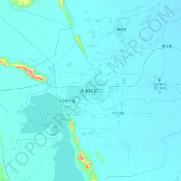
Name: Tumshuq topographic map, elevation, terrain.
Location: Tumshuq, Boundary Maralbeshi - Kashgar, Xinjiang, China (39.70649 78.91240 40.02649 79.23240)
Average elevation: 3,622 ft
Minimum elevation: 3,560 ft
Maximum elevation: 5,479 ft
Thank you for supporting this site ❤️
Make a donation
Make a donation
Gear up for your next adventure:
As an Amazon Associate, this site earns from qualifying purchases at no extra cost to you.