Geolocate

Price topographic map

Click on the map to display elevation.

About this map

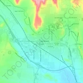
Name: Price topographic map, elevation, terrain.

Location: Price, Carbon County, Utah, United States (39.57867 -110.83472 39.62289 -110.77818)

Average elevation: 5,614 ft

Minimum elevation: 5,466 ft

Maximum elevation: 6,001 ft

Gear up for your next adventure:

🌲Outdoor Survival Books - Best books on survival skills
🔥Plasma Lighters - Windproof lighters that work in any weather condition
🗻Climbing Gear Basics - Essential gear for beginner climbers
🪶LED Camping Lantern - Bright lantern for camp lighting
Solar GPS Watches - Advanced multisport watches with built-in topographic maps

As an Amazon Associate, this site earns from qualifying purchases at no extra cost to you.