
Thank you for supporting this site ❤️
Make a donation
Make a donation
Gear up for your next adventure:
As an Amazon Associate, this site earns from qualifying purchases at no extra cost to you.
Mandau/Mandava topographic map
Click on the map to display elevation.
Thank you for supporting this site ❤️
Make a donation
Make a donation
Gear up for your next adventure:
As an Amazon Associate, this site earns from qualifying purchases at no extra cost to you.
About this map
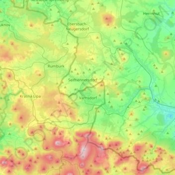
Name: Mandau/Mandava topographic map, elevation, terrain.
Location: Mandau/Mandava, Görlitz, Saxony, 02782, Germany (50.88836 14.48307 50.96147 14.82588)
Average elevation: 1,362 ft
Minimum elevation: 696 ft
Maximum elevation: 2,566 ft
Thank you for supporting this site ❤️
Make a donation
Make a donation
Gear up for your next adventure:
As an Amazon Associate, this site earns from qualifying purchases at no extra cost to you.