
Thank you for supporting this site ❤️
Make a donation
Make a donation
Gear up for your next adventure:
As an Amazon Associate, this site earns from qualifying purchases at no extra cost to you.
FELDA Neram 1 topographic map
Click on the map to display elevation.
Thank you for supporting this site ❤️
Make a donation
Make a donation
Gear up for your next adventure:
As an Amazon Associate, this site earns from qualifying purchases at no extra cost to you.
About this map
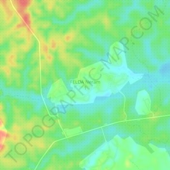
Name: FELDA Neram 1 topographic map, elevation, terrain.
Location: FELDA Neram 1, Kemaman District, Terengganu, Malaysia (3.99119 103.25402 4.03119 103.29402)
Average elevation: 128 ft
Minimum elevation: 52 ft
Maximum elevation: 253 ft
Thank you for supporting this site ❤️
Make a donation
Make a donation
Gear up for your next adventure:
As an Amazon Associate, this site earns from qualifying purchases at no extra cost to you.