
Thank you for supporting this site ❤️
Make a donation
Make a donation
Gear up for your next adventure:
As an Amazon Associate, this site earns from qualifying purchases at no extra cost to you.
Eilat topographic map
Click on the map to display elevation.
Thank you for supporting this site ❤️
Make a donation
Make a donation
Gear up for your next adventure:
As an Amazon Associate, this site earns from qualifying purchases at no extra cost to you.
About this map
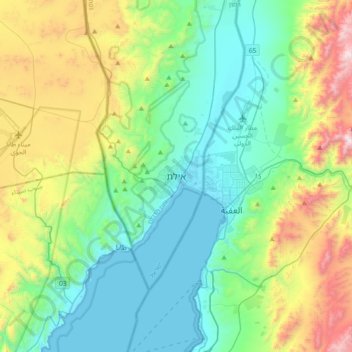
Name: Eilat topographic map, elevation, terrain.
Location: Eilat, Beersheba Subdistrict, South District, 88104, Israel (29.39693 34.78979 29.71693 35.10979)
Average elevation: 1,381 ft
Minimum elevation: 0 ft
Maximum elevation: 5,148 ft
Thank you for supporting this site ❤️
Make a donation
Make a donation
Gear up for your next adventure:
As an Amazon Associate, this site earns from qualifying purchases at no extra cost to you.